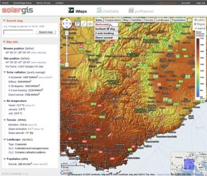
"iMaps and pvPlanner as a part of SolarGIS online system integrate the best-available solar resource database, covering continuous history of 17 years, with the latest scientific knowledge and best practices in solar and photovoltaic simulation", said Marcel Suri, Managing Director of GeoModel Solar.
In a written release, the company said project developers can quickly and easily identify sites with high insulation, to maximise electricity production and economic profitability of solar energy projects.
Engineers, installers, financers,policy-makers and wider community can access this state-of-the-art software suite from the webbased platform http://solargis.info.
"SolarGIS iMaps provides access to key solar resource parameters with a spatial detail of 250 meters, thus allowing for accurate data query, sites selection and comparison, and informed decision making about the best position for a prospective photovoltaic, concentrated photovoltaic or concentrated solar power project," Suri said.
iMaps offers unlimited access to the relevant site-specific climate and geographic data required for prefeasibility studies, supported by the data reports and high-resolution interactive maps. Once a site is selected, photovoltaic electricity yield can be interactively estimated by pvPlanner.
SolarGIS pvPlanner simulates long-term electricity production of photovoltaic projects ranging from large open-space power plants to roof-top systems and rural electrification projects. For small and medium-size photovoltaic systems, pvPlanner reports are bankable as they benefit from validated insulation resource data, state-of-the-art knowledge and best practices in energy simulation learned in previous projects, such as the EU initiative PVGIS.
For additional information:

