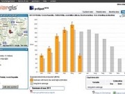
The comparison of actual and expected energy production is the best indicator of performance. For evaluation, expected production must be calculated precisely. This is only possible if site-specific solar radiation information is available in real time.
Until now, a typical practice has been to acquire data from cheap sensors or nearby meteo stations. Such approaches compromise on accuracy of solar radiation. Installing high-quality pyranometers and related hardware is a better solution, but challenges still remain. Ground measurements are often subject to errors due to missing or inconsistent data, shaded or unclean sensors, and they require rigorous quality checking.
Satellite-based solar radiation is a reliable option for investors and lenders. pvSpot uses data from SolarGIS, recognised as the most accurate solar resource database on the market.
“The solar industry needs independent data and approaches for transparent evaluation of existing PV capacities” said Marcel Suri, managing director of GeoModel Solar. “Because pvSpot uses high-resolution validated satellite data and proven algorithms, independence and quality of performance assessment is guaranteed. While pvSpot can be used as a complementary tool for well-monitored utility scale PV projects, it is practically the only reliable solution for medium-size and small PV installations.”
GeoModel has already showcased its pvSpot system at the EUPVSEC exhibition in Frankfurt and according to the company the system was also recently acknowledged at the SNEC exhibition in Shanghai as one of the ten most advanced technologies in PV.
Further information available at:

