This is the first independent scientific field study validating the benefits of using turbine mounted LIDAR to correct rotor-induced yaw misalignment. An AEP increase of 2.4 percent has been estimated for a 7.5° misalignment.
The research project, supported by DOE, focused on the optimization of turbine performance using forward-looking wind LIDAR measurements, with a focus on improvement of power output by correcting yaw misalignment and a reduction in turbine O&M costs through improved load mitigation. The research was conducted in collaboration with Avent Lidar Technology and Renewable NRG Systems.
“Wind turbines traditionally rely on a wind vane mounted on the rear of the nacelle to measure the wind direction in order to control the yaw position of the turbine," said Andrew Scholbrock, Field Test Engineer at NREL.
"Certain factors, like rotor-induced wakes, can lead the vane to measure the wind direction inaccurately," he continued. "The principle focus of the project was to use a LIDAR to measure the wind direction ahead of the rotor and derive a correction function. The correction function was shown to reduce the yaw misalignment and improve power capture in below rated power wind speeds.”
The study also validated the energy increase after yaw misalignment correction using the Wind Iris as an external reference sensor. The power curve improvement was measured and found to be nearly identical with wind speeds measured from the LIDAR and NREL’s reference meteorological tower.
Based on the results, it is estimated that LIDAR-based yaw correction will increase the annual energy production (AEP) by 2.4 percent for a 7.5° static misalignment and standard reference wind speed distribution.
“Yaw misalignment correction is a hot topic in turbine O&M optimization. These field-results will give us a strong edge in a market where no other type turbine mounted LIDARs have that kind of scientific track record”, said Thomas Velociter, CEO of Avent.
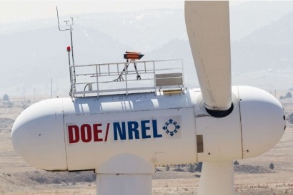
NREL served as the overall project coordinator with the measurement campaign taking place at its National Wind Technology Center in Golden, Colorado. The LIDAR was installed on the two-bladed Controls Advanced Research Turbine (CART2).
NREL performed data collection and analysis related to the use of LIDAR measurements. Avent provided its Wind Iris LIDAR for the project together and performed part of the scientific analysis related to LIDAR technology. Renewable NRG Systems was responsible for the coordination of the LIDAR field activities.
Following the evaluation of static yaw misalignment correction, NREL, Avent and Renewable NRG Systems are set to begin a new collaboration phase to explore the use of LIDAR measurements to actively control the wind turbine, through improved rotor collective pitch and yaw control.
The Wind Iris is the only industry proven turbine LIDAR for power performance verification and optimization applications. It measures the horizontal wind speed and direction at hub height from 40m to 400m upwind of the turbine, and generates accurate data to optimize wind turbine performance.
It combines unparalleled operational features, validated procedures and methodologies, and has a strong track record of over 100 deployments onshore and offshore. This unique combination allows operators and owners to yield a high return on investment turbine after turbine with clear and easy to implement processes.
For additional information:

